BY ANGELA DEL CARMEN, CEO AT IMAGERYST
The devastating floods caused by the recent DANA in Valencia left behind submerged fields, damaged infrastructure, and disrupted communities—a stark reminder of nature’s force. For many, the immediate focus is recovery.
At Imageryst, we understand that clear and timely information is critical in these moments. That’s why we’re offering free land analysis to help the most affected—farmers, municipalities, NGOs, and decision-makers—gain the insights they need to navigate the aftermath effectively, as the United Nations Office for Disaster Risk Reduction emphasized.
Through topographical and data-driven terrain analysis, we empower communities not just to rebuild, but to plan smarter for a more resilient future.
WHY LAND ANALYSIS MATTERS
Recovering from a flood isn’t just about rebuilding; it’s about getting to know and understand the land. By combining georeferenced datasets like elevation, slope orientation, and terrain gradients with almost real-time insights on soil humidity and vegetation health, we provide a comprehensive view of what’s happening on the ground.
This analysis supports critical decisions:
- Where is the greatest damage concentrated?
- Which areas are at risk for future flooding?
- How can we assess the depth of the damage?
- What resources are needed, and where?
Building Resilience from the Ground Up
The foundation of recovery starts with understanding the terrain. Traditionally, this relied on topographical surveys—time-consuming efforts that offered only static snapshots. Today, tools like Imageryst and programs such as the Copernicus Programme provide dynamic, evolving insights that adapt as conditions change.
For example:
- Topographical Context: Understanding slope and elevation informs better drainage and infrastructure planning.
- Data-Driven Insights: Regular updates on soil humidity and vegetation health help identify which areas remain viable for recovery.
- Risk Mitigation: flood data and current terrain conditions pinpoint vulnerabilities, supporting smarter reconstruction strategies.
This dual approach—combining traditional methods with modern data tools—ensures recovery is not only efficient but also designed for long-term resilience.
What Imageryst Offers
Our free tools are designed to support recovery efforts with:
- Accurate monitoring
Tracking soil humidity and water flow progression, supported by insights from the European Environmental Agency, we help identify which zones remain most affected and where resources are urgently needed. - Damage Assessment
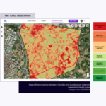
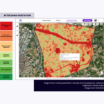
Visual comparisons before and after the DANA provide clear evidence of impact, supporting resource allocation and recovery planning. - Smarter Planning and Risk Mitigation
Data on current conditions highlights flood-prone areas, guiding the design of resilient infrastructure and land-use strategies.
These insights go beyond recovery—they help communities rebuild stronger and better prepared for future challenges.
Why Resilience Matters
Floods are not a one-time event. With climate change intensifying weather patterns, as the Intergovernmental Panel on Climate Change (IPCC) reported, disasters like DANA are becoming more frequent. The question is no longer if environmental catastrophes will happen, but how prepared we’ll be when they do.
Land analysis doesn’t just help in recovery—it’s a cornerstone of resilience. By understanding vulnerabilities and planning strategically, we can:
- Prevent future damage.
- Optimize resource allocation.
- Protect communities and ecosystems.
At Imageryst, we combine geo-referenced data to provide actionable insights that drive better decisions.
How We’re Supporting Recovery in Valencia
Imageryst’s initiative is designed to reach those who need it most:
- Farmers: Identify which fields can still be salvaged.
- NGOs and municipalities: Prioritize resources for maximum impact.
- Planners: Pinpoint vulnerabilities to reduce future risks.
We are here to support, inform, and empower communities as they take their next steps toward recovery and resilience.
Join Us in Making an Impact
Communities like South Summit inspire collaboration to tackle global challenges with innovation. Through data-driven land analysis, we’re creating smarter strategies together.
If you or someone you know has been affected by DANA, contact us at dana@imageryst.com to learn more.


